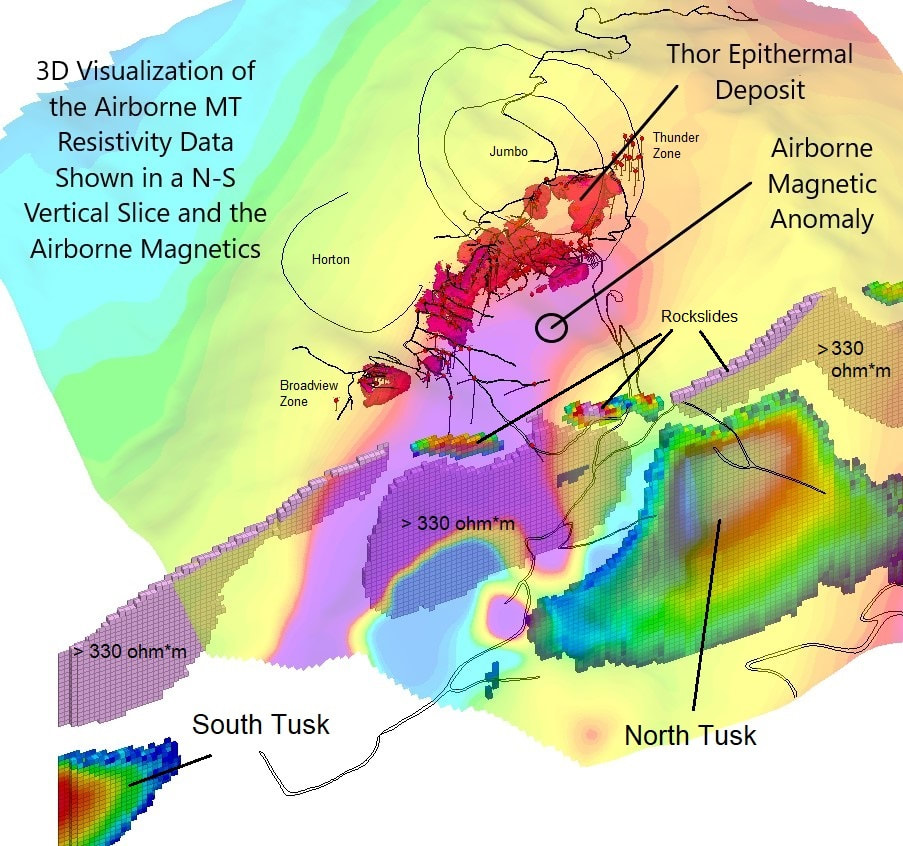
geophysical Cross Sections
|
In May of 2022, Taranis engaged Expert Geophysics to undertake an airborne magnetic and magnetotelluric survey of the project. This proved to be an ideal survey instrument since the survey was completed with a helicopter, and was able to navigate the steep terrain, and still obtain valuable information about the physical characteristics of the rocks that occurred at Thor.
Magnetotellurics is an ideal type of geophysical survey to use at Thor to try and locate buried intrusive bodies because of its depth of penetration (~1.5km) and its ability to map conductivity and resistivity throughout the depth spectrum. The data is acquired using a very unique airborne system, and requires extensive processing to produce meaningful data. In addition to the resistivity sections it was able to produce, it also used an airborne magnetometer that was able to map some of the lithologies at Thor. This magnetic feature is of interest to Taranis, because it is believed to be related to a concealed intrusive body that underlies the Thor epithermal deposit. You can see how the Thor epithermal deposit is intimately associated with the west side of a prominent magnetic anomaly that Taranis knows exists at depth below the surface. We interpret this to be an intrusive body. |
